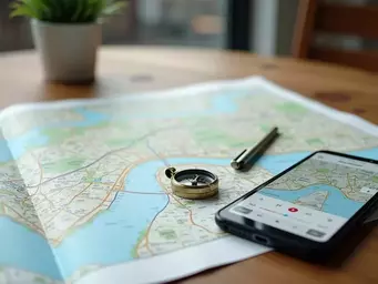
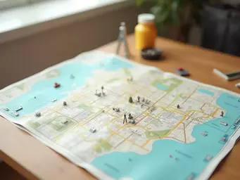
Mapping Urban Safe Zones Together
In the heart of urban life, knowing where to find refuge can be the difference between chaos and safety. What if you could pinpoint your local safe zones before an emergency strikes? Understanding urban safe zones not only prepares you for unpredictable situations but also fosters a culture of community resilience.
As someone deeply invested in urban preparedness, I often emphasize the need for city dwellers to identify these safe havens in advance. It's not just about having a plan; it's about ensuring you and your loved ones know where to turn when the going gets tough. That’s where our expertise at Urban Safety and Navigation Solutions comes into play—helping you pinpoint these critical locations.
What Are Urban Safe Zones?
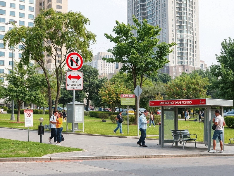
Urban safe zones are designated areas within a city that have been identified as secure locations in times of crisis. They are strategically chosen based on factors like accessibility, security, and availability of resources. Think of them as the city's safety net—places where emergency services can be facilitated, and community members can find refuge and assistance.
- Accessibility: Safe zones should be easy to reach, even without a car.
- Visibility: These areas need to be well-known to residents, ensuring everyone can locate them quickly.
- Resources: Ideally, safe zones offer emergency supplies, medical aid, or shelter from harmful elements.
By understanding what urban safe zones are, we can better prepare ourselves and our communities. It's not just about having a list of locations; it's about fostering a culture of safety and awareness among city residents.
The Importance of Emergency Preparedness in Urban Areas
Emergency preparedness is vital for urban living, as cities face unique challenges during crises. The dense population and confined spaces often complicate evacuation efforts and increase risks. Therefore, establishing a robust emergency plan centered around urban safe zones is essential.
- Minimizing Panic: Preparedness reduces anxiety and confusion in emergency situations.
- Effective Communication: Knowing safe zones enhances the flow of information during crises.
- Community Cohesion: Planning together fosters a sense of shared responsibility and awareness.
At Urban Safety and Navigation Solutions, we believe that preparedness empowers individuals. By educating ourselves about emergency protocols and safe zones, we can help ensure everyone's safety when it matters most.
How Urban Planning Contributes to Community Resilience
Urban planning plays a critical role in enhancing community resilience. Thoughtful design can significantly influence how effectively a community responds to emergencies. By incorporating safe zones into city layouts, planners can create environments that support both safety and accessibility.
- Green Spaces: Parks can serve as natural refuge points with ample space for gathering.
- Infrastructure: Well-designed roads and pathways facilitate quick evacuation routes to safe zones.
- Community Centers: These spaces can double as shelters, providing vital services during emergencies.
As we continue our mission at Urban Safety and Navigation Solutions, we advocate for urban planners to prioritize safety in their designs. For a deeper understanding of how urban planning intersects with safety, the UN-Habitat Safer Cities program offers valuable insights into creating secure and resilient urban environments. Together, we can create cities that not only thrive in everyday life but also stand strong in the face of adversity.
Did You Know?
According to recent studies, cities with well-defined safe zones can reduce emergency response times by up to 30%. This highlights the importance of not just identifying safe locations, but also ensuring they are accessible and communicated effectively to all residents.
Frequently Asked Questions About Urban Safe Zones
- What are urban safe zones?
- Urban safe zones are designated areas within a city that provide refuge and support during emergencies. They are chosen based on factors like accessibility, security, and resource availability.
- Why is emergency preparedness important in urban areas?
- Emergency preparedness is crucial in urban areas due to dense populations and confined spaces, which can complicate evacuation and increase risks. Preparedness helps minimize panic, ensures effective communication, and fosters community cohesion.
- How does urban planning contribute to community resilience?
- Thoughtful urban planning enhances community resilience by integrating safe zones into city layouts. This includes designing green spaces as refuge points, well-structured infrastructure for evacuation, and community centers that can serve as shelters.
- What key elements define an effective urban safe zone?
- Effective urban safe zones are characterized by accessibility (easy to reach without a car), visibility (well-known to residents), and resources (offering emergency supplies, medical aid, or shelter).
- How can communities encourage ongoing engagement in preparedness efforts?
- Communities can encourage ongoing engagement through workshops, outreach programs, social media updates, and by forming local preparedness groups. This empowers residents to take proactive steps for their safety.
Summarizing the Path to Effective Urban Safe Zone Mapping
As we wrap up our discussion on urban safe zone mapping, it's essential to distill the key takeaways that can empower urban planners and emergency services. Identifying safe zones is not just a theoretical exercise; it’s about creating actionable strategies that can make a real difference during emergencies.
Here are some crucial takeaways I believe every planner and emergency service should consider:
- Understand community needs: Prioritize the unique aspects of your urban environment. For more information on understanding community safety indicators, refer to the UN-Habitat report on safety indicators, which provides a framework for assessing and improving urban safety.
- Utilize technology: Leverage GIS and real-time data to enhance your mapping accuracy.
- Engage the community: Foster collaboration with residents to pinpoint valuable safe locations.
- Regularly update plans: Ensure that your safe zone maps evolve with community changes.
By focusing on these areas, we can enhance our collective urban resilience, ensuring that every city dweller knows where to head when the unexpected strikes!
Encouraging Ongoing Community Engagement and Preparedness Efforts
Community engagement is the heartbeat of effective emergency preparedness It's crucial to foster a culture of preparedness by continually involving residents in the conversation about urban safe zones.
To encourage ongoing participation, consider these strategies:
- Host community workshops: Invite residents to participate in mapping exercises.
- Develop outreach programs: Create informative campaigns on the importance of safe zones.
- Utilize social media: Share updates on safe zone locations and emergency drills.
- Form local preparedness groups: Gather community members to create a network of safety advocates.
As the founder of Urban Safety and Navigation Solutions, I can attest to the impact of community involvement. When individuals feel empowered and informed, they’re more likely to take proactive steps towards their safety and that of their neighbors For further reading on urban safety initiatives and community involvement, the UNODC's urban safety resources offer valuable perspectives on international efforts and best practices.
Recap of Key Points
Here is a quick recap of the important points discussed in the article:
- Identify Urban Safe Zones: Recognize locations such as parks, community centers, and places of worship that serve as refuge during emergencies.
- Emergency Preparedness: Establish robust emergency plans that minimize panic, enhance communication, and foster community cohesion.
- Urban Planning for Resilience: Incorporate safe zones in city designs to facilitate accessibility and effective response during crises.
- Engage the Community: Host workshops, outreach programs, and utilize social media to keep residents informed and involved in safety initiatives.
- Utilize Technology: Leverage tools like GIS and real-time data for accurate mapping of safe zones.

Samantha V. Rivers
As an urban preparedness expert and the voice behind "Safe Locations and Navigation," I help city residents navigate emergencies with confidence. My strategies combine practical experience with thorough research to empower individuals in identifying safe zones and mastering navigation techniques. Through Urban Safety and Navigation Solutions, I provide actionable guides on survival mapping, route planning, and real-world evacuation scenarios, fostering situational awareness and preparedness in uncertain environments.
Popular Posts
Safe Routes and Shelters Guide
![Where to Find Safe Routes and Emergency Shelters: A City Resident’s Guide to Crisis Navigation]() In the face of unexpected events, the key to survival lies in preparedness. Imagine navigating a cit
In the face of unexpected events, the key to survival lies in preparedness. Imagine navigating a cit
 In the face of unexpected events, the key to survival lies in preparedness. Imagine navigating a cit
Finding Urban Survival Maps Easily
![Where to Buy Reliable Survival Maps and Navigation Tools for Urban Emergencies]() Are you prepared for the unexpected in our bustling urban environments? Understanding the essential
Are you prepared for the unexpected in our bustling urban environments? Understanding the essential
 Are you prepared for the unexpected in our bustling urban environments? Understanding the essential
Create Your Urban Survival Map
![Step-by-Step Guide to Creating Your Own Urban Survival Map: From Landmarks to Evacuation Routes]() Have you ever found yourself questioning how to navigate your urban environment in times of crisis?
Have you ever found yourself questioning how to navigate your urban environment in times of crisis?
 Have you ever found yourself questioning how to navigate your urban environment in times of crisis?
Urban Navigation Without GPS Guide
![Step-by-Step Guide to Navigating Urban Areas Without GPS During Crises]() When it comes to navigating through an urban crisis, your smartphone might not always be your best f
When it comes to navigating through an urban crisis, your smartphone might not always be your best f
 When it comes to navigating through an urban crisis, your smartphone might not always be your best f