Create Your Urban Survival Map

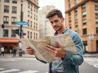
Have you ever found yourself questioning how to navigate your urban environment in times of crisis? Creating a personalized survival map could be the answer. This guide will equip you with the knowledge to enhance your emergency preparedness and feel confident in any situation.
What You Will Learn
- The significance of crafting a personalized urban survival map for enhanced situational awareness.
- Key components to include on your map, such as local landmarks and evacuation routes.
- An overview of popular mapping tools like Google Maps and ArcGIS, and their respective advantages.
- The benefits of combining both digital and physical maps for comprehensive emergency preparedness.
- How Geographic Information Systems (GIS) can enhance your mapping efforts with advanced data analysis.
- Strategies for community engagement through sharing maps and collaborating on safety planning.
- Practical tips for integrating your map into safety protocols and conducting emergency drills.
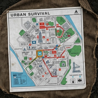
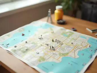
Urban Survival Map Key Components and Mapping Tools
Understanding the essential elements of an urban survival map and the tools available to create it is crucial for effective emergency preparedness. The visual below highlights these key components and popular mapping tools.
Key Components of an Urban Survival Map
- Landmarks: Hospitals, Police Stations, Community Centers
- Transportation: Subway, Bus Stops, Major Streets
- Hazards: Flood Zones, High-Crime Areas
Popular Mapping Tools Overview
- Google Maps: General navigation, landmark finding
- ArcGIS: Advanced mapping, detailed data layers
- OpenStreetMap: Free, editable, local details
Digital vs. Physical Map Options
- Digital Maps: Accessible, shareable, updatable
- Physical Maps: Reliable during outages, GPS failures
GIS for Advanced Mapping
- Detailed Layers: Information customization
- Analyze Patterns: Population density, emergency locations
- Share Insights: Collaborative safety planning
Understanding the Importance of an Urban Survival Map
In an urban setting, having a well-thought-out survival map can make all the difference in an emergency. You might be thinking, "Why do I need a map when I have GPS?" But as someone who has navigated the complexities of city life during unexpected situations, I can assure you that understanding how to create your own urban survival map is not just beneficial—it’s essential!
Creating a personal map tailored to your unique environment helps enhance your situational awareness. Think of your urban survival map as your personal roadmap to safety, guiding you through potential hazards and towards safe locations during crises. For further reading on the importance of emergency preparedness, consider visiting resources like the Ready.gov website, which offers comprehensive guides and checklists.
Why Create Your Own Urban Survival Map?
One might wonder, what’s the value of crafting a personal urban survival map? The answer lies in empowerment and preparedness! By mapping out your surroundings, you can:
- Identify safe zones and emergency resources in your community.
- Plan routes that avoid high-traffic areas during evacuations.
- Enhance your knowledge of local landmarks and their significance.
Creating your own map gives you the opportunity to tailor it to your specific needs and local knowledge, which a generic digital map simply can’t provide.
Key Components of Effective Urban Survival Mapping
When developing an urban survival map, there are key components you shouldn't overlook. The first is local landmarks. These can be anything from parks to public buildings that may serve as gathering places or shelters. Secondly, consider incorporating transportation networks, which can help guide your escape routes during an emergency.
- Landmarks: Identify hospitals, police stations, and community centers.
- Transportation: Highlight subway stations, bus stops, and major streets.
- Hazards: Note potential risks in your area, such as flood zones or high-crime locales.
Your map is only as effective as the information it contains. So, take the time to gather and mark these essential components!
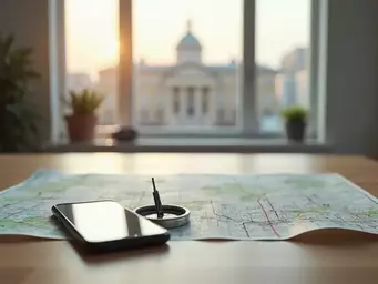
Choosing the Right Tools for Mapping
Now that you understand the importance of an urban survival map, let’s explore the tools that can assist you in crafting this invaluable resource. Whether you prefer digital options or physical maps, there are numerous choices available.
Overview of Popular Mapping Tools: Google Maps, ArcGIS, and More
Several mapping tools can help you create your urban survival map. Here’s a glance at some popular options:
- Google Maps: Great for general navigation and finding landmarks.
- ArcGIS: Offers advanced mapping capabilities and detailed data layers.
- OpenStreetMap: A free, editable map of the world that's useful for local details.
Each tool has its unique features, so explore what resonates with your needs and preferences!
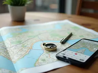
Evaluating Digital vs. Physical Map Options
When it comes to mapping, you might feel torn between going digital or sticking with a classic paper map. Digital maps are easily updated and often provide real-time data, while physical maps can be crucial when technology fails. It’s a good idea to have both options available.
- Digital Maps: Easily accessible, shareable, and updatable.
- Physical Maps: Reliable during power outages and GPS failures.
Ultimately, having both forms at your disposal can ensure that you are prepared for any scenario.
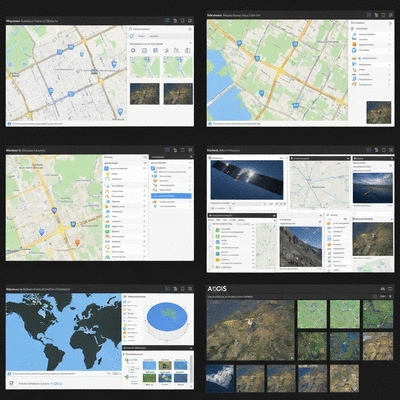
Exploring Geographic Information Systems (GIS) for Advanced Mapping
If you're ready to take your mapping to the next level, consider exploring Geographic Information Systems (GIS). GIS software allows you to analyze spatial data, enabling a more comprehensive understanding of your urban environment. With tools like QGIS or ArcGIS, you can:
- Create detailed layers for different types of information.
- Analyze data patterns, such as population density or emergency service locations.
- Share your insights with community members for collaborative safety planning.
Investing time in learning these systems can significantly enhance your urban survival mapping efforts. For more detailed insights into GIS technology and its applications, the U.S. Geological Survey (USGS) GIS page provides valuable resources.
Engage Your Community!
Have you considered how sharing your urban survival map can strengthen community ties? Engaging with your neighbors not only fosters collaboration but also enhances everyone's preparedness. What are some local landmarks or safe zones you think should be included in community maps? Share your thoughts below!
Summarizing the Benefits of Personal Urban Survival Maps
Creating a personal urban survival map is more than just a helpful exercise; it's a crucial step towards enhancing your emergency preparedness. By mapping out your surroundings, you empower yourself to navigate through urban emergencies with confidence. This proactive approach allows you to identify safe zones, escape routes, and key resources, all tailored to your specific needs and local environment.
Think of your map as a personalized guide that enhances your situational awareness. In stressful situations, having a clear visual representation of your city can significantly improve your crisis management skills. Not only are you better prepared, but you can also make informed decisions quickly, which is vital for ensuring your safety and that of your loved ones.
How Your Map Enhances Emergency Preparedness and Crisis Management
The benefits of a personalized urban survival map extend well beyond mere navigation. Consider the following ways it can bolster your preparedness:
- Improved situational awareness: Knowing where you are and your surrounding features helps you to remain calm and think clearly.
- Quick access to essential resources: Locate hospitals, shelters, and emergency services at a glance, making them easy to reach during a crisis.
- Customized evacuation routes: Tailored paths ensure you can avoid hazards and reach safety efficiently.
By enhancing your emergency preparedness with a well-thought-out map, you're not just planning for the worst; you're also cultivating a proactive mindset that benefits you and your community.
Encouraging Community Engagement and Sharing Your Map
One of the most rewarding aspects of creating your urban survival map is the opportunity to engage with your community. Sharing your map with neighbors and local groups fosters collaboration and can lead to collective preparedness efforts. Consider hosting a neighborhood gathering to discuss your mapping experience and encourage others to create their own maps.
- Invite feedback: Getting input from your community can help you refine your map and discover additional resources.
- Share best practices: Exchange tips for navigating urban emergencies that can benefit everyone.
- Build a network of support: Strengthening relationships within your community can provide crucial assistance during emergencies.
Remember, a community that prepares together is a community that can respond effectively together in times of need!
Utilizing Your Map for Safety Protocols and Emergency Drills
Your urban survival map is a dynamic tool that can significantly enhance your safety protocols. By regularly incorporating it into emergency drills, you can ensure that everyone in your household knows how to use it effectively. Here are some ways to make the most of your map during practice scenarios:
- Conduct drills: Simulate various emergencies to practice the evacuation routes and safety measures highlighted on your map.
- Review regularly: Update your map as new resources or hazards emerge in your environment.
- Educate others: Share your knowledge and map with friends or family, reinforcing community preparedness.
Incorporating your urban survival map into safety protocols not only builds confidence but also strengthens the resilience of your entire community. Together, we can face any urban challenge with preparedness and poise!
Next Steps for Creating and Using Your Urban Survival Map
Now that you understand the benefits of having your personalized urban survival map, it’s time to take action! Creating and utilizing your map is a journey that involves continuous learning and adaptation.
Frequently Asked Questions (FAQs)
- Q: Why is a personalized urban survival map important?
- A: A personalized urban survival map is crucial for enhancing situational awareness and emergency preparedness. It helps you identify safe zones, evacuation routes, and critical resources tailored to your specific environment, which generic maps cannot provide.
- Q: What key components should I include on my urban survival map?
- A: Essential components include local landmarks (hospitals, police stations, community centers), transportation networks (subway, bus stops, major streets), and potential hazards (flood zones, high-crime areas).
- Q: What mapping tools are recommended for creating an urban survival map?
- A: Popular tools include Google Maps for general navigation, ArcGIS for advanced mapping with detailed data layers, and OpenStreetMap for editable, local details. It's often beneficial to use a combination of these.
- Q: Should I use digital or physical maps for survival?
- A: It's recommended to have both. Digital maps are easily updated and shareable, while physical maps are reliable during power outages or GPS failures, ensuring you're prepared for any scenario.
- Q: How can Geographic Information Systems (GIS) enhance my mapping efforts?
- A: GIS software allows for advanced spatial data analysis, enabling you to create detailed layers, analyze patterns (like population density or emergency service locations), and share insights for collaborative safety planning.
- Q: How can I involve my community in urban survival mapping?
- A: Share your map with neighbors, invite feedback to refine it, exchange tips for navigating emergencies, and build a network of support. Community engagement fosters collective preparedness and resilience.
- Q: How should I integrate my urban survival map into safety protocols?
- A: Incorporate your map into regular emergency drills to practice evacuation routes, review and update your map as your environment changes, and educate others by sharing your knowledge and map with friends and family.
Recap of Key Points
Here is a quick recap of the important points discussed in the article:
- Creating a personal urban survival map enhances situational awareness and emergency preparedness.
- Identify local landmarks, transportation networks, and potential hazards for effective mapping.
- Utilize both digital tools (like Google Maps and ArcGIS) and physical maps for comprehensive navigation options.
- Incorporate your map into emergency drills to build confidence and familiarity with escape routes.
- Engage your community by sharing maps and experiences to foster collective preparedness.

Samantha V. Rivers
As an urban preparedness expert and the voice behind "Safe Locations and Navigation," I help city residents navigate emergencies with confidence. My strategies combine practical experience with thorough research to empower individuals in identifying safe zones and mastering navigation techniques. Through Urban Safety and Navigation Solutions, I provide actionable guides on survival mapping, route planning, and real-world evacuation scenarios, fostering situational awareness and preparedness in uncertain environments.
Popular Posts
Safe Routes and Shelters Guide
![Where to Find Safe Routes and Emergency Shelters: A City Resident’s Guide to Crisis Navigation]() In the face of unexpected events, the key to survival lies in preparedness. Imagine navigating a cit
In the face of unexpected events, the key to survival lies in preparedness. Imagine navigating a cit
 In the face of unexpected events, the key to survival lies in preparedness. Imagine navigating a cit
Finding Urban Survival Maps Easily
![Where to Buy Reliable Survival Maps and Navigation Tools for Urban Emergencies]() Are you prepared for the unexpected in our bustling urban environments? Understanding the essential
Are you prepared for the unexpected in our bustling urban environments? Understanding the essential
 Are you prepared for the unexpected in our bustling urban environments? Understanding the essential
Create Your Urban Survival Map
![Step-by-Step Guide to Creating Your Own Urban Survival Map: From Landmarks to Evacuation Routes]() Have you ever found yourself questioning how to navigate your urban environment in times of crisis?
Have you ever found yourself questioning how to navigate your urban environment in times of crisis?
 Have you ever found yourself questioning how to navigate your urban environment in times of crisis?
Urban Navigation Without GPS Guide
![Step-by-Step Guide to Navigating Urban Areas Without GPS During Crises]() When it comes to navigating through an urban crisis, your smartphone might not always be your best f
When it comes to navigating through an urban crisis, your smartphone might not always be your best f
 When it comes to navigating through an urban crisis, your smartphone might not always be your best f